Backyard.
Backyard.
Go to the ant.....
My view today.
The Old Bridge.
Monday afternoon.
Kitimat, BC Canada - Lakelse Lake
Saturday ride.
One garden photo today.
The Backyard Campfire.
In a dark spot behind our shed.
Well, British Columbia, Canada
Preparing for a ride.
Flower Detail
Near Tobiano,Kamloops BC
Using a worn out shoe.
View from front door.
View from front door.
Taken through the kitchen window.
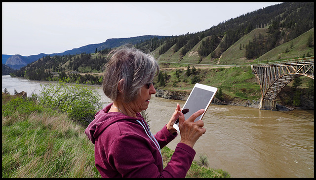
Fraser River near Williams Lake, BC
Near Meldrum Creek, BC
Fraser River, Chilcotin Highway.
Old homestead, Meldrum Creek BC
It is better to listen to a crow that lives in tre…
Back Yard Crow.
Central British Columbia, Canada
The one and only one in our yard so far.
West Fraser Park
Old wreck - Studebaker.
Facing East.
Fraser River, Quesnel, BC Canada
Fraser River, Quesnel, BC Canada
1/400 • f/7.1 • 11.0 mm • ISO 200 •
OLYMPUS IMAGING CORP. E-M1
OLYMPUS M.7-14mm F2.8
EXIF - See more detailsAuthorizations, license
-
Visible by: Everyone -
All rights reserved
-
77 visits
Linda at the Fraser River Bridge near Williams Lake, BC


Highway 20 is scenic and very sparsely populated. It begins in Williams Lake at its juncture with Highway 97. It rises gradually for 23 km (14 mi) to the crossing of the Fraser River at Sheep Creek Bridge, from which it ascends via a series of steep switchbacks to the Chilcotin Plateau. Prior to improvements of the late 20th Century, including the Sheep Creek Bridge, it crossed the Fraser via a 1910s style suspension bridge, which was like those farther south at Gang Ranch-Dog Creek and Lillooet.
At 36 km (22 mi) it passes the Williams Lake LORAN-C Tower, part of the maritime navigation system. This tower was dismantled in October 2011.
At 52 km (32 mi) it passes through Riske Creek (population 165) then at 94 km (58 mi) the hamlet of Hanceville (population 68).
Around 104 km (64 mi) it passes Anahim Reserve, a Chilcotin community before reaching Alexis Creek (population 317) at 114 km (71 mi). From Alexis Creek it is 122 km (76 mi) to the next town, Tatla Lake (population 147).
54 km (34 mi) farther West is Nimpo Lake which serves as a float plane base for the region. Just west of Nimpo Lake the highway crosses the Dean River before reaching Anahim Lake (population 163) and the adjacent Indian reserve at 310 km (193 mi). 35 km (22 mi) west of Anahim Lake, the highway enters Tweedsmuir South Provincial Park, and 6.2 km (3.9 mi) later, it crosses into the Central Coast Regional District at Heckman Pass. After another 20 km (12 mi), the highway meets the Atnarko River, and follows it west for 18 km (11 mi) to where the Atnarko merges with the Talchako River to form the Bella Coola River. Highway 20 then follows the Bella Coola River for 10 km (6 mi) to a bridge over Burnt Bridge Creek, at which point it exits the Park. After continuing to follow the Bella Coola River for another 27 km (17 mi), the highway reaches Hagensborg, then another 20 km (12 mi) to the centre of Bella Coola (population 2500), and then another 4.8 km (3.0 mi) to the BC Ferry terminal.
Nouchetdu38, Fred Fouarge have particularly liked this photo
- Keyboard shortcuts:
Jump to top
RSS feed- Latest comments - Subscribe to the comment feeds of this photo
- ipernity © 2007-2025
- Help & Contact
|
Club news
|
About ipernity
|
History |
ipernity Club & Prices |
Guide of good conduct
Donate | Group guidelines | Privacy policy | Terms of use | Statutes | In memoria -
Facebook
Twitter

Gary Schotel club has replied to Fred Fouarge clubSign-in to write a comment.