On test server

Informações
Encontro de poesia popular num pequeno monte de me…
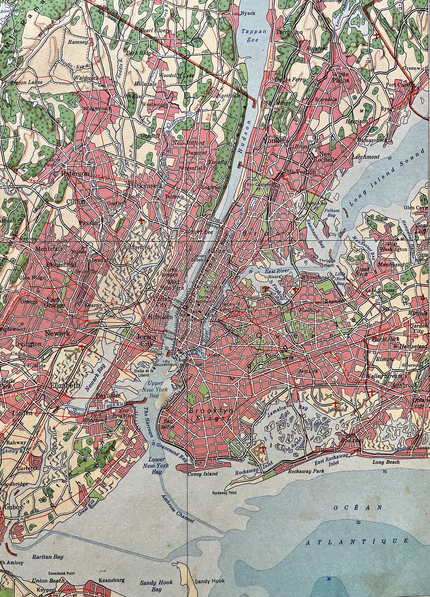
Plano de New York em 1954.
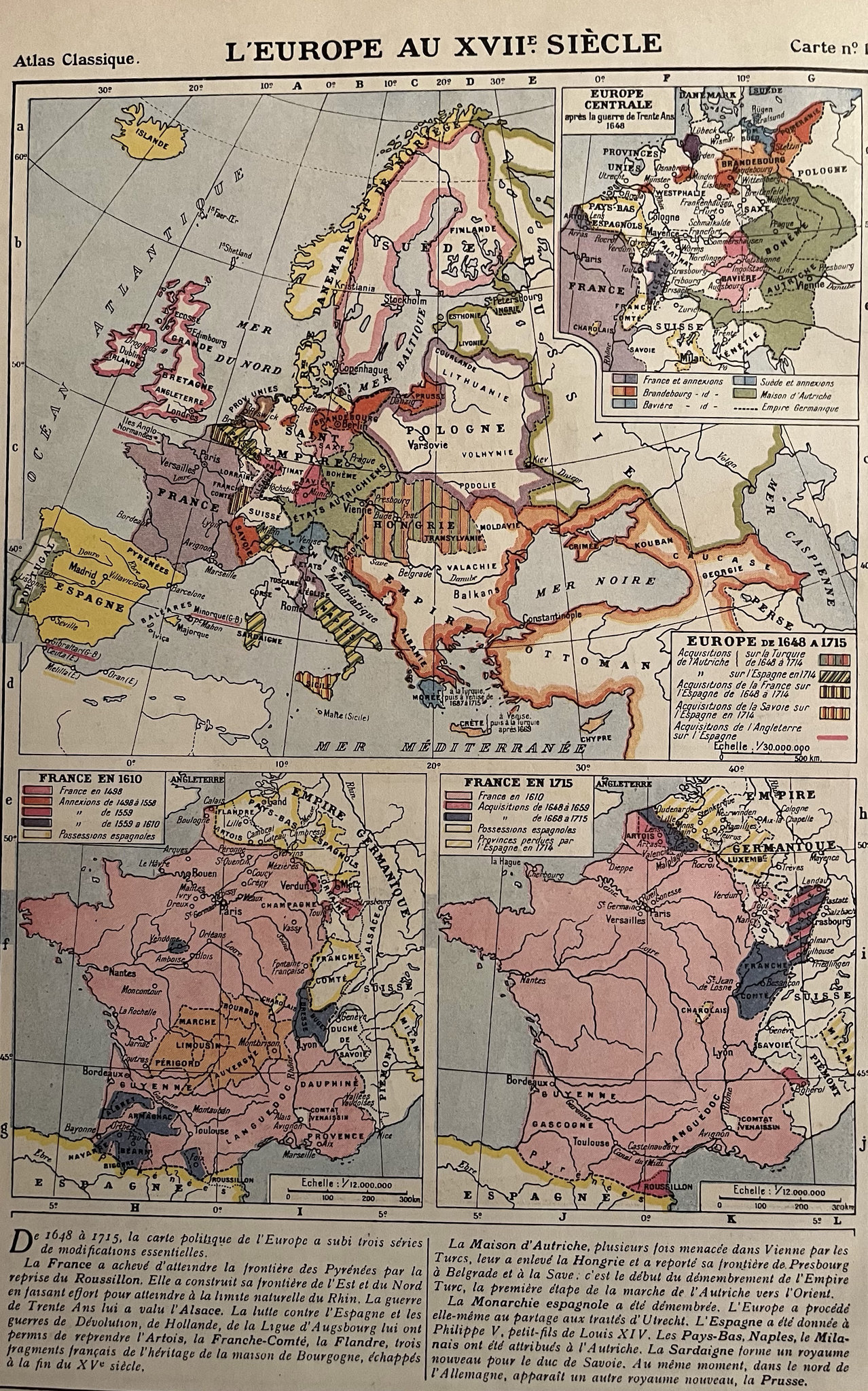
Europa do século XVII
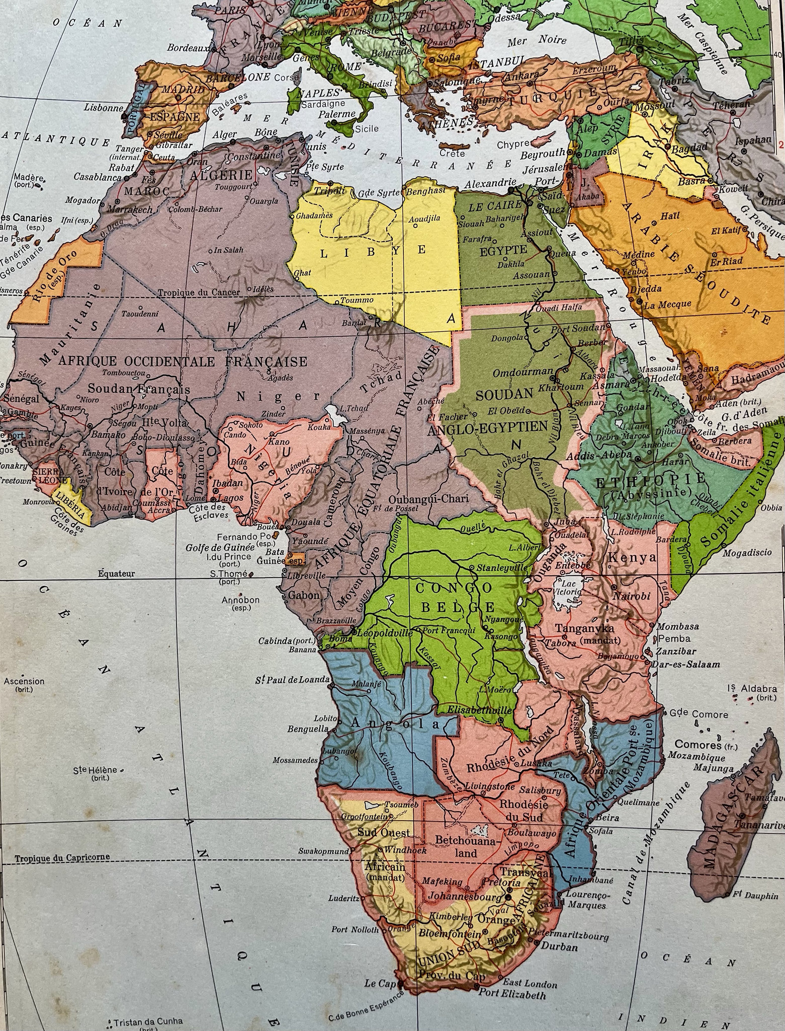
Mapa da Africa do tempo da colonização
Penedos, podem ver a minha casa !
Monte Gordo: por do sol.
Her and me !
Marais salants de Castro Marim (Algarve).
Zelijes
IMG 0132
Cores!
S!
Citrinus da produção local.
Moinho de café do início do século XX.
Cartazes, Mértola
L1003738
Alguns queijos europeus.
Carnival of blood.
Zona de caça.
Penedos, Pasture growing after first rain
Penedos, Casa Pedro
Gospel in Algarve?
Panier et boîtes
See also...
Authorizations, license
-
Visible by: Everyone -
All rights reserved
-
29 visits
Atlas da decada 1950


PIPs
Mapa da Africa do tempo da colonização
Plano de New York em 1954.
Europa do século XVII
+++++
Fotografia de dois atlas da década de 1950. Um atlas histórico das civilizações mediterrânicas na época da Segunda Guerra Mundial e um atlas geográfico que, devido à sua idade, é também histórico porque, como se pode ver no mapa da África política, os países ainda não tinham conquistado a sua independência.
.
Translate into English
Mapa da Africa do tempo da colonização
Plano de New York em 1954.
Europa do século XVII
+++++
Fotografia de dois atlas da década de 1950. Um atlas histórico das civilizações mediterrânicas na época da Segunda Guerra Mundial e um atlas geográfico que, devido à sua idade, é também histórico porque, como se pode ver no mapa da África política, os países ainda não tinham conquistado a sua independência.
.
Annemarie, Gillian Everett, William Sutherland, Xata and 4 other people have particularly liked this photo
- Keyboard shortcuts:
Jump to top
RSS feed- Latest comments - Subscribe to the comment feeds of this photo
- ipernity © 2007-2025
- Help & Contact
|
Club news
|
About ipernity
|
History |
ipernity Club & Prices |
Guide of good conduct
Donate | Group guidelines | Privacy policy | Terms of use | Statutes | In memoria -
Facebook
Twitter
Thanks JP.
Sign-in to write a comment.