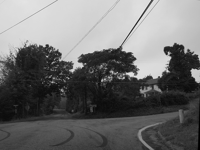
Connecticutt Road
You can trace most of the Connecticutt Road from Plaine Hill to Hockanum.
Some of it is in a state little removed from what it was like in the 1600s, and a couple of those parts are on public land and can still be walked.
Some of it is in a state little removed from what it was like in the 1600s, and a couple of those parts are on public land and can still be walked.
01 Sep 2013
Hartford Old Road (at Pine Hill)
Lines, viewing west on Center Turnpike at the intersection where the road from the Westford Congregational Meeting House across Pine Hill to ran north to Union. Pine Hill was called White Pine Hill or Troop's Hill in some town records. Lots on Pine Hill were laid out in 1718.
The turnpike must have been considered a fairly direct route, to be designated as a Post Road. A Stage line ran daily between Boston and Hartford. This was called the Telegraph Road in some records, after the Telegraph Stage. Other turnpikes had Telegraph Stage lines as well.
"The Center Turnpike Company was incorporated in Connecticut in May, 1826, to build from the Tolland courthouse through Willington, Ashford, Union, and Woodstock to the Massachusetts line in Dudley, where it connected with the road of the Central Turnpike Corporation." (Turnpikes, 194, 195)
Wood, Frederic I., The Turnpikes of New England and Evolution of the Same Through England, Virginia and Maryland, Boston, 1919
13 Sep 2015
Singers, Lake Siog, Holland MA, 2015
35th Annual Nipmuck Powwow, Holland MA. Chaubunagungamaug Band of Nipmuck Indians.
30 Apr 2014
Ford way, Circa 1730 - 1746
First part o a deed from Thomas Acley to Thos Lampkin. Book B - 124.
The description of the bounds starts on the eleventh line with "Butting & Bounding as followeth begining at a stake... ".
This is the third in a series of transactions for a 40 acre parcel of land abutting a fording place on the Willimantic River. The fording place is above (upstream of) where the Center Turnpike bridge crossed the Willimantic River which is just above where the Wilber Cross Parkway of the late 1930s and the present day Interstate I84 crosses the Willimantic River.
The first transaction dated December 11, 1730 is the sale for "thirty six pounds money in hand" by Daniel Eaton of Tolland to Moses Rowley of East Haddam. The second transaction dated April 7, 1732 is a sale by Moses Roulee, now of Middletown for "the sum of forty pounds currant money" to Thomas Acley of Haddom Est. The third transaction dated May 12, 1746 is a sale for "60 pounds old tenar" by Thomas Acley of East Haddam to Thos. Lampkin of Wellington.
The description of the bounds are similar in all three deeds except for some minor changes such as the distance of the second to last bound from the path from Stafford, changing from two rods to five rods and exchanging "path over willimantic" for "ford way".
30 Apr 2014
Ford way, Circa 1730 - 1746 continued.
Second part of a deed from Thomas Acley to Thos Lampkin. Book B - 125.
The business or legal end of the transaction verbiage. Sometimes this end of the document or "instrument" can go a full page with the signature and "seal" running over to another page.
Jump to top
RSS feed- Latest items - Subscribe to the latest items added to this album
- ipernity © 2007-2025
- Help & Contact
|
Club news
|
About ipernity
|
History |
ipernity Club & Prices |
Guide of good conduct
Donate | Group guidelines | Privacy policy | Terms of use | Statutes | In memoria -
Facebook
Twitter


