Sierra Buttes
Sego, Utah
Elvis is watching her......Elvis la regarde......
Bud Light Spanish girl in high heels - Recadrage
Bud Light Spanish girl in high heels and rap dance…
Snowy path
Eagle guardian?
Sutter Buttes
Middle Fork of the Feather River
Canyon de Chelly
Who's Walking Whom?
Der Zaun in New Orleans
French Quarter
Die Reste nach der Parade
Bold Sunrise Pastel Sky
Golden Gate Bridge
Point Bonita lighthouse
West Gemini Bridge
Natchez
State Line
Bidwell Bar suspension bridge
Rock Creek Dam
Coastal fortifications at The Presidio
Under The Bridges In Brighton Beach, New York
US - Twin Falls - Shoshone Falls
Mesquite Flat Sand Dunes, Death Valley
Comin' at Ya
Grand Canyon Sunset
Fall Colors (H.A.N.W.E.)
Le cobaye
Boston / Waterboat Marina (USA)
Lunch, Acme Oyster House, Mandeville, Louisiana (H…
"Sunshine is helpful for thinking. It warms up the…
Great Sand Dunes National Park, Colorado
WIldflowers at Goosenecks State Park, Utah (H.A.N.…
Bodie The Ghost Town, California
Fire and Water
Old West Street, American Frontier
Bryce Canyon
Colonial Era Burial Ground
Half Dome In Yosemite National Park
San Diego
Brick Arches
Valley Fog
Location
Lat, Lng:
You can copy the above to your favourite mapping app.
Address: unknown
You can copy the above to your favourite mapping app.
Address: unknown
See also...
Keywords
Authorizations, license
-
Visible by: Everyone -
All rights reserved
-
543 visits
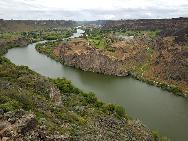
Snake River Canyon


Twin Falls, Idaho. Looking downstream (west) from near the southern end of the I.G. Perrine (US Highway 93) bridge. I thought the golf course nestled improbably amongst the craggy outcrops was an interesting touch! As I've noted elsewhere, this canyon was scoured and deepened about 18K years ago by the so-called Bonneville Flood, when Pleistocene Lake Bonneville overtopped a drainage divide into the Snake's drainage basin. The resulting rapid downcutting led to the natural equivalent of a dam failure. Lake Bonneville covered much of western Utah (the Great Salt Lake is a highly shrunken remnant), and it suddenly lost the top few hundred feet of water depth as a result of the flood. Geomorphological evidence indicates that at peak flow this canyon was filled brim to brim.
Gudrun, Tractacus, Pam J, William Sutherland have particularly liked this photo
- Keyboard shortcuts:
Jump to top
RSS feed- Latest comments - Subscribe to the comment feeds of this photo
- ipernity © 2007-2025
- Help & Contact
|
Club news
|
About ipernity
|
History |
ipernity Club & Prices |
Guide of good conduct
Donate | Group guidelines | Privacy policy | Terms of use | Statutes | In memoria -
Facebook
Twitter

Admired in:
www.ipernity.com/group/tolerance
Sign-in to write a comment.