Location
Lat, Lng: 39.611466, -118.180486
You can copy the above to your favourite mapping app.
Address: 89406, Fallon, Nevada
You can copy the above to your favourite mapping app.
Address: 89406, Fallon, Nevada
See also...
See more...Keywords
Authorizations, license
-
Visible by: Everyone -
All rights reserved
-
730 visits
Dixie Valley


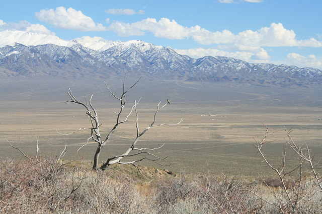
In central Nevada, looking east across to the Clan Alpine Range. Mt. Augusta (9966 ft/3038 m) is the high snowcapped peak at the left. The Clan Alpines are not usually this snow-covered; it's been a wet year!
Dixie Valley is an asymmetric graben, a fault-bounded trough where the faulting on the west side (i.e., here) is more active. The Stillwater Range, which defines the west side of the valley, is being uplifted with respect to the valley floor. The fault movement is ongoing to this day; in December 1954, a rupture along the range front here caused an enormous earthquake (Richter magnitude ~ 7.4) and left a fault scarp 10-15 ft high (~3-5 m). The quake would have caused tremendous damage in a populated area; as it was, no one was injured and the only damage was a toppled outhouse! This area is part of what's called the Central Nevada Seismic Belt, a north-south trending zone where other large earthquakes have occurred historically. I'll post pix of some of the fault scarps at some point.
And no, I haven't ID'd the bird on the snag!
tiabunna, Gudrun, Berny, Andy Rodker and 8 other people have particularly liked this photo
- Keyboard shortcuts:
Jump to top
RSS feed- Latest comments - Subscribe to the comment feeds of this photo
- ipernity © 2007-2025
- Help & Contact
|
Club news
|
About ipernity
|
History |
ipernity Club & Prices |
Guide of good conduct
Donate | Group guidelines | Privacy policy | Terms of use | Statutes | In memoria -
Facebook
Twitter


slgwv club has replied to Pam J clubAdmired in:
www.ipernity.com/group/tolerance
Wonderful picture, I love those very long shots of emptiness in Nevada.
slgwv club has replied to Don Barrett (aka DBs…slgwv club has replied to Andy Rodker clubslgwv club has replied to Gudrun clubSign-in to write a comment.