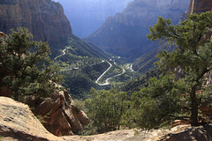
Shooting information for this photo
← Back to the photo page
Want to know more about EXIF?
Check wikipedia page about Exchangeable image file format (EXIF)
Check wikipedia page about Exchangeable image file format (EXIF)
Some of EXIF data are only available in English.
| Camera: | Canon EOS 7D Mark II |
|---|---|
| Exposure: | 0.008 sec. (1/125) |
| Aperture: | f/10.0 |
| Focal Length: | 27.0 mm (35 mm equivalent: 42.6 mm) |
| Flash: | Off, Did not fire |
| Exposure mode: | Manual |
| Resolution: | 72 x 72 dpi |
| Dimension: | 5472 x 3648 pixels |
| Original Date: | 2023:04:27 20:27:35.00 |
| Created on: | 2023:04:27 20:27:35.00 |
| Modified on: | 2023:06:30 06:14:18.00 |
| Software: | Adobe Photoshop Elements 7.0 Windows |
| Artist | Picasa |
| Circle Of Confusion | 0.019 mm |
| Color Mode | RGB |
| Color Space | Uncalibrated |
| Components Configuration | Y, Cb, Cr, - |
| Compression | JPEG (old-style) |
| Creator | Picasa |
| Custom Rendered | Normal |
| Exif Version | 0230 |
| Exposure Compensation | 0 |
| Exposure Mode | Manual |
| Field Of View | 45.8 deg |
| Flash Fired | False |
| Flash Function | False |
| Flash Mode | Off |
| Flash Red Eye Mode | False |
| Flash Return | No return detection |
| Flashpix Version | 0100 |
| Focal Plane Resolution Unit | inches |
| Focal Plane X Resolution | 6086.76307 |
| Focal Plane Y Resolution | 6090.15025 |
| Format | image/jpeg |
| Gamma | 2.2 |
| Hyperfocal Distance | 3.83 m |
| ICC Profile Name | Adobe RGB (1998) |
| ISO | 200 |
| Image Size | 5472x3648 |
| Interoperability Index | R03 - DCF option file (Adobe RGB) |
| Interoperability Version | 0100 |
| Lens Info | 18-135mm f/0 |
| Lens Model | EF-S18-135mm f/3.5-5.6 IS USM |
| Light Value | 12.6 |
| Metadata Date | 2023:06:30 06:12:41-07:00 |
| Metering Mode | Multi-segment |
| Native Digest | 256,257,258,259,262,274,277,28 4,530,531,282,283,296,301,318, 319,529,532,306,270,271,272,30 5,315,33432;4F1B9B047BB2BD4E04 1DC8F29A1A69D9 |
| Primary Chromaticities | 0.64 0.33 0.21 0.71 0.15 0.06 |
| Rating | 0 |
| Recommended Exposure Index | 200 |
| Related Image Height | 3648 |
| Related Image Width | 5472 |
| Resolution Unit | inches |
| Scale Factor To 35 mm Equivalent | 1.6 |
| Scene Capture Type | Standard |
| Sensitivity Type | Recommended Exposure Index |
| Sub Sec Time | 00 |
| Sub Sec Time Digitized | 00 |
| Sub Sec Time Original | 00 |
| Thumbnail Offset | 1818 |
| White Balance | Auto |
| White Point | 0.313 0.329 |
| XMP Toolkit | XMP Core 5.1.2 |
| Y Cb Cr Coefficients | 0.299 0.587 0.114 |
| Y Cb Cr Positioning | Co-sited |
GPS Information |
|
| GPS Altitude | 1589.3 m Above Sea Level |
| GPS Altitude Ref | Above Sea Level |
| GPS Date Stamp | 2023:04:28 |
| GPS Date/Time | 2023:04:28 00:29:27.705Z |
| GPS Dilution Of Precision | 2.1 |
| GPS Img Direction Ref | Magnetic North |
| GPS Latitude | 37 deg 12' 48.83" N |
| GPS Latitude Ref | North |
| GPS Longitude | 112 deg 56' 45.40" W |
| GPS Longitude Ref | West |
| GPS Map Datum | WGS-84 |
| GPS Measure Mode | 3-Dimensional Measurement |
| GPS Position | 37 deg 12' 48.83" N, 112 deg 56' 45.40" W |
| GPS Satellites | 24 |
| GPS Status | Measurement Active |
| GPS Time Stamp | 00:29:27.705 |
| GPS Version ID | 2.3.0.0 |
Jump to top
- ipernity © 2007-2025
- Help & Contact
|
Club news
|
About ipernity
|
History |
ipernity Club & Prices |
Guide of good conduct
Donate | Group guidelines | Privacy policy | Terms of use | Statutes | In memoria -
Facebook
Twitter
